Friday, 28 June 2013

Early summer low flow

Stage = 30.5cm, Ta = 21.5C, Tw = 16.1C

The snowmelt season is over for the Takiya River Basin, and now we are waiting for the rainy season to arrive and swell the flow in the river. The hydrograph below shows that there is a false start to the rainy season around 20 June, after which dry conditions return. Together with late summer in September, this time of year before rainy season has some of the lowest flows of the year.


Tuesday, 4 June 2013

Tail end of snowmelt season


After 2-3 months of snowmelt and sustained moderately high flows, the past two weeks have seen a steady decline in stage. The snow-covered area has really decreased rapidly, and normally disappears by early June for Takiya River. Note the continued dry weather and diurnal snowmelt pattern, which contrasts with the single rainfall event of May 31st.

Today's special job was to use anti-rust paint on the logger boxes which hold the stage data loggers for Takiya River and the tributary. These steel boxes are highly rust resistent, but having been in the forest continuously for up to 13 years, some much needed maintenance was in order.

Stage = 38.5cm, Ta = 20.0C, Tw = 13.6C

Friday, 17 May 2013

Diurnal melt pattern


During fine weather the daily fluctuations in air temperature strongly control snowmelt and the stream discharge as seen clearly in the hydrograph above. The level of flow in Takiya River remains high due to snowmelt. With continuing fine weather during the rest of May we expect to see these diurnal wave patterns becoming less pronounced and then disappearing altogether when the snowpack has fully melted off.

Stage = 56cm, Ta = 12.8C, Tw = 9.3C
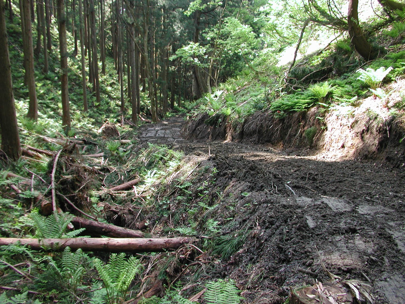
Zero-order basin where soil temperatures are monitored (0-100cm depth) at 200m asl
New forest road has been carved out of this narrow valley (starting 2012) to allow a partial cut of the cedars

Tuesday, 30 April 2013

Cool weather dampens snowmelt


Unseasonably cool weather put the brakes on the snowmelt season through late April. The peaks on the hydrograph below are more to do with rainfall events than warm weather snowmelt. This year it looks like the snowmelt season with continue well into May.

Friday, 19 April 2013

Snowmelt season


The last month or so has shown consistently high river stage and discharge which is typical of the snowmelt season. The hydrograph given above shows that stage has been mostly between 60cm and 80cm with three peaks, the largest of which is at over 110cm. Rain-on-snow has been an important factor in generating these peaks, and the classic pattern of snowmelt diurnal peaks created during fine weather are not easily seen. Some snow remained at the higher elevation young cedar lysimeter site, but melt-off was complete for the other lysimeter sites.

Stage = 66cm, Ta = 5C, Tw = 6C

Mature cedar lysimeter site after melt-off

Larch lysimeter site after melt-off

Young cedar lysimeter site after melt-off

Tuesday, 19 March 2013

Spring rain-on-snow

First major rain-on-snow event of the season. Stage = 95cm, water temp. = 5.3C.

Warm temperatures up to 11.6 C and intense rain showers (3.5 mm/h) through the night and during the morning of the 19th led to typical rain-on-snow conditions and a moderately high discharge in Takiya River (stage about 1m).


Two students and I completed a snow survey of three locations (deciduous larch, mature cedar, and open paddy field). The snow pack beneath the mature cedar remained much firmer and more icy compared to the other two sites, which can be explained by the different energy balance between sites. During such rain-on-snow events we would expect the net radiation balance and the energy brought by warm winds to be greater in the open and deciduous larch sites.

The larch site had the highest snow water equivalent (SWE) and the greatest snow depth. The paddy and mature cedar site had similar SWE, but the depth was less and the density higher in the paddy where liquid water content was particularly high at the base of the snow pack.

Snow depths (cm)
Paddy: 52
Cedar: 72
Larch: 88

Snow survey in the larch site

Tuesday, 12 March 2013

Late winter

Snowmelt water is crystal clear. Stage = 58cm.
Takiya River stage hydrograph (Nov 2012 to Mar 2013)

Today I serviced all the snow lysimeters, and also downloaded the river water level data enabling me to plot the stage hydrograph for the entire winter season as above. This winter is notable for the absence of any large rain-on-snow events during January and February as cold conditions continued. Precipitation is predominantly snow from mid-December to the end of February. Warmer conditions early March have given two moderate peaks already. Interestingly, the winter minimum low flow of about 40cm stage is roughly the same as the summer low flow stage of last September. Generally we expect the winter low flow to be a little higher due to basal melt of the snowpack and minimal ET during winter.

We are just about to enter the snowmelt season, and mountain snowpacks reach their peak during the month of March, at least in the Takiya River catchment. I was surprised to see that the water level was already a little high at 58cm - likely due to rain-on-snow over the previous weekend, though a trace of new snow had also fallen.

Early this morning temperatures plummeted to -6.5 degrees C for the tributary young cedar site (coldest temperature recorded there all winter). Must have been even colder in the valley bottoms. Clear skies, low humidity and still conditions gave extreme radiative cooling overnight, but warm air moved in during the day and temperatures reached the teens. However, in the shady spots the snowpack remained frozen solid all day. Lots of fresh monkey tracks in the snow.

Larch lysimeter

Mature cedar lysimeter

Young cedar lysimeter

View towards Japan Sea (left) and Miomote River (centre) at about 300m asl

Same viewpoint looking north across lower part of Takiya catchment (right-hand peak about 640m asl)