Wednesday 21 December 2011

Winter arrives

Stage = 50.5cm, Q = 0.96m3/s

December 16 brought the sudden arrival of winter. The weather changed from mild sunny days to snow. And once the snow arrives it usually continues right through to early April. I was caught out by not having the snow lysimeters fully primed and ready for the arrival of snow. So I was digging out and cleaning the lysimeters while the students made a discharge measurement in rather frigid conditions.

We also did our first snow survey of the season. About 23cm snow depth and 5cm snow water equivalent (SWE) at the larch site giving a snow density (SWE/depth) of about 0.2. We charged the winter precipitation storage gauge with anti-freeze at the paddy field site, but we ran out of time to climb up to the tributary site. That would be our job next time in early January.

Snow survey (larch site): depth 22.8cm, SWE 4.6cm, density 0.20.

Winter storage gauge at the paddy field site

Wednesday 30 November 2011

Rising baseflows

Stage = 57cm, Ta = 7C, Tw = 10C
From the hydrograph below we can see that the stage has been quite high at 60-70cm during late November due to some steady rains. There are no large peaks, however, as rainfall intensities have been moderate. This has raised the baseflow level as we head into December.

Wednesday 16 November 2011

Snow lysimeter fixed

Stage = 51.5cm, Ta = 4.6C, Tw = 9.2C


Today's work included measuring discharge for Takiya River and the tributary, then fixing the leak in the drainage pipe at the mature cedar snow lysimeter site. The third lysimeter tray had become disconnected at the elbow, likely when the tray was moved during a flood. We repositioned the tray and reconnected and glued the PVC pipe quite easily.

The first snows of winter have already fallen in Niigata. We could see snow on the mountains down to about 500m elevation. For the high peaks this snow will stay and accumulate right through the winter, but for the lower elevations the snow will come and go through autumn until winter arrives for real.

PVC pipe reconnected and glued at the elbow

Wednesday 26 October 2011

Autumn recession flow

Stage = 55.5cm, Ta = 8.7C, Tw = 12.4C

The hydrograph below shows and long period of recession flow (6 days) during which the weather was dry, followed by a medium size peak due to a rainfall event. Notice how the flow recession is steep right after the peak, becoming more gradual as the water level falls.

Wednesday 19 October 2011

Dragon-fly season

Stage = 51cm, Ta = 8.8C, Tw = 11.6C

Dragon-fly season in fall brings some perfect weather for fieldwork. The air was dancing with red dragon-flies or "aka tonbo" as they are known in Japanese. I introduced two new students to Takiya River field site, and showed them how to make a discharge measurement. Our work went very smoothly - I think they will make a great team.

You can see in the hydrograph below that September and October has brought some periods of heavy rain, with two flood peaks of around 90cm. See how the summer low-flow season came to an end around 19th September, and how the base flows have increased in recent weeks. This is due to the frequent rain showers, and the much cooler temperatures and reduced evapotranspiration (ET) which comes with the autumn season.

Friday 30 September 2011

A helping hand

Stage = 46cm, Ta = 16.8C, Tw = 15.5C

Today I received a helping hand from two students who are considering joining my lab for their graduation thesis next year. I introduced them to the Takiya River monitoring site, and the surrounding Miomote and Murakami region.

We took the all-important discharge measurement, and I then gave them a quick tour of the lower part of the basin. It was cool and raining a little, but I hope that my student guests could appreciate the beauty of the river and the importance of the research work being done there. Perhaps it caught their interest?

The light rain had raised the water level just a little above the summer low flow stage. The rains also brought some surface runoff and added grey-coloured fine sediment to the water.

Friday 9 September 2011

Summer low flow


Today I visited Takiya River for the first time in about a month. Over the past month the river has basically shown the summer low flow condition with stage at around 40-45cm. There are some rainfall events, and one flood reached nearly 1m stage, but these are all short-lived events and the river stage quickly fell back to the summer low flow condition. Groundwater levels are decreasing steadily as indicated by the decrease in low flows between rain events. Surface soil conditions are extremely dry.

Stage = 42.5cm, Ta = 23.5C, Tw = 17.9C

Friday 12 August 2011

Takiya flood report


Takiya stage hydrograph showing flood of 28-29 July
The record-breaking rains that hit central Niigata Prefecture over 28-30 July were not so intense in northern Niigata and the Miomote Basin. In the stage hydrograph above we can see a double peak flood over 28-29 July and the maximum stage of about 1.3m is only a medium size flood for the Takiya Basin.

Today I visited the field to check the situation after the rains and to make a routine discharge measurement. I had to clean some debris from around the staff gauge, and there were some new deposits of gravel on both the left and right banks. Horsefly ("abu") season is in full swing, but I was not troubled so much by them. If you keep still, then they seem to disperse. No leeches today - the ground is baked dry after hot dry weather all this month.

Takiya: stage = 45cm, Ta = 27.1C, Tw = 16.1C
Miomote River at Nunobe showing low-flow condition

Sunday 31 July 2011

Record-breaking rains

Uonuma River at Horinouchi

Shinano River at Ojiya

Ohkozu Bunsui at Watabe

Shinano River at Kamo City

Agano River at Maoroshi

Agano River at Yokogoshi

During July 28-30, the Niigata and Fukushima regions were attacked by record-breaking storms as a rainy season type weather pattern developed pushing cooler air from the north into hot and humid air from the south. The result was explosive storms and record rainfall intensities. Over the 3 days, 619mm of rainfall was recorded in Kamo City, with 290mm recorded in a single day on July 29. That's equivalent to twice the average July rainfall in just 3 days! Examples of record rainfall intensities are 94mm/hr in Kamo City and 121mm/hr in Tokamachi. All this rain led to record-breaking high water levels in most of the rivers of the Niigata plains, and several rivers burst their banks flooding nearly 9000 homes and businesses.

Above I have given several examples of stage hydrographs showing record high water levels, including the Uonuma River which is a tributary of the Shinano River, the Ohkozu diversion channel which reduces flooding on the lower Shinano River, and the Agano River. Even though the Ohkozu diversion channel was diverting record amounts of flow into the Japan Sea, the lower Shinano River still suffered flooding in some low-lying areas. Fortunately the river levees were built up to a higher level after the last major flood of 2004, and this must have reduced the flood damage on this occassion.

Ohkozu diversion channel upper sill (July 30)

Ohkozu diversion channel entering the Japan Sea (July 30)

Thursday 28 July 2011

Campus Cloudburst

A river flows in front of the Agriculture Building

A cascade forms on the steps in the main plaza

The basement of the Agriculture Building was in danger

Today an extremely violent thunderstorm and cloudburst caused flash-flooding and chaos in Niigata City. Ikarashi Campus was totally awash, and in particular the Agriculture Building suffered a close call when drains became inundated or blocked by debris. The rainfall intensities must have been >50mm/hr, but unfortunately the Niigata Amedas rain gauge was unable to obtain any data during the storm.

Tuesday 26 July 2011

Summer arrives early


This year the rainy season was very short. Heavy rain began spectacularly on June 23, but it was all over by July 8. From July 8-25 a long dry spell set in with severe summer heat in the 30s every day. River levels are already very low and unless we have some frequent rains this summer, we are looking at some severe water shortages. Tainai River is already totally dry below the mountains due to water extraction for paddy field irrigation.

Takiya River: stage = 44.5cm, Q = 0.384m3/s, Ta = 23.1C, Tw = 18.1C

Plenty of wildlife to be seen today - monkeys, kamo shika deer (mother and kid), and kingfisher (kawa semi). The water temperature is perfect for a cooling swim at lunchtime.


Sand bags used to divert Takiya's flow into the irrigation channel

Takiya River's single irrigation channel just upstream from confluence with Miomote River

Monday 11 July 2011

Stage-discharge (H-Q) curves

The stage-discharge relationship (often called H-Q curve) is fundamental for stream-gauging sites. Everybody knows that higher water levels in the river generally mean greater discharge. But for a natural cross-section (no weir structure), the exact relationship between water level (stage or H) and discharge (Q) must be determined through field measurements. Stream-gauging sites normally have a pressure sensor and data logger which records water level at say 10 minute intervals, so that we can plot the stage hydrograph. The H-Q curve allows us to estimate discharge from stage, so that we can plot the discharge hydrograph.

Every time we visit Takiya River we make a discharge measurement and read the stage. We can then plot a new point on the stage-discharge curve, either confirming the existing H-Q curve, or sometimes showing us that there has been a shift in the curve. Shifts in the curve can happen during big floods when there is a change in the supply of sediment, causing a change in the elevation of the stream bottom. The big flood of 23 June last month caused such a shift in the H-Q curve as shown below:


The pink data points show the two most recent discharge measurements, indicating a shift to the right of about 10cm for the H-Q curve. This means that for the same discharge amount, the water level is now about 10cm higher than it was before the 23 June flood event, due to accumulation of gravel in the channel. Also plotted are the three previous H-Q curves and we can see that recently the curve has shifted every year. This means that we have to work hard to keep establishing the new H-Q curve each year before there is another shift! Ideally we need about 20-30 measurements across a wide range of flows, but often we have to make do with much less data and a less well defined H-Q curve.

The river is too dangerous during big floods to be able to take a discharge measurement by wading in the water, and so we have no points on the H-Q curve for high stage values. We must extrapolate the H-Q curve to estimate these peak flow discharge values, and therefore we have large degrees of uncertainty. The chart below shows the previous H-Q curves extrapolated up to 2m, indicating that the flood peak of 23 June had a discharge of approximately 100 m3/s! However, we must try alternative techniques for measuring discharge during peak flows to try to confirm the H-Q curve at these high flow levels.

Tuesday 5 July 2011

Rain showers

Stage = 66.5cm, Ta = 18.5C, Tw = 13.5C
Today there were a few rain showers at Takiya River. Looking at the hydrograph, there have been several small rain-storms over the past week. I'm not sure what caused the sudden dip in the water level on July 3rd, but I think we can ignore that. Water temperature still relatively cold at just 13.5 degrees. My legs were cold standing in the river taking the discharge measurement. Small gravel bed load transport could still be seen through the slightly muddy water.


Miomote River was also flowing high still and carrying visible suspended sediment in the muddy water. Gravel bed load transport is limited in the Miomote River due to three large dams constructed in the basin.

Miomote River with morning mist

Monday 27 June 2011

June 23 flood stage = 2.126m!!

Today I visited Takiya River to get the data from last week's flood, and to check for any damage. Luckily there was no damage, but there was a large pile of debris hooked around the staff gauge. I cleaned it all away and better secured some wiring with nylon ties.

Staff gauge covered in debris
I could just about wade in the river to take a discharge measurement. I suspect the stage-discharge relationship (H-Q curve) has changed as there seemed to be a fresh accumulation of gravelly sediment in the channel. As often occurs after heavy rain, the water temperature had dropped down so that it was quite cold (14.4C), and the warm humid air above produced a strange fog over the river (see also Miomote River photos below).

Stage = 75cm, air temp. = 18.3C, water temp. = 14.4C
Below I have plotted the hydrograph for the few days around the June 23 big flood event, when peak stage reached 2.126m, about equal 3rd highest flood stage since monitoring began in September 2000. Note how the precipitation intensities of >8mm/10 minutes caused the two largest peaks during the flood.

Stage hydrograph with Miomote (Amedas) precipitation data

Miomote River at Nunobe, below confluence with Takiya River (left)


Miomote River with Takiya River basin in centre-ground between mountains

Friday 24 June 2011

Arakawa River (and Takiya) in flood


Arakawa River stage hydrograph (updated 6/29)

Yesterday's heavy rain did indeed cause the Arakawa River to flood dramatically. Water levels rose from about 1m to over 5m, and nearly hit the high mark of 5.95m reached during the big flood of July 2004, which brought much destruction and damage to Niigata Prefecture.

Today more heavy rain is causing water levels to rise again! Looking at the precipitation data for the Arakawa River basin above the Odo gauging station (see Tochikura and Gomisawa in links panel) we see that about 300mm has fallen since yesterday morning, with maximum intensities of 10mm/10 minutes (equivalent to 60mm/h). This is an extraordinary amount of rainfall, approaching the daily amounts recorded in Kyushu last week. When the seasonal rain front runs into steep mountain relief we can get these record amounts of rainfall.

If only I had real-time water level data for Takiya! Like the Arakawa River, Takiya River must also be in a major flood. Looking at the Miomote and Takane precipitation data (see links panel) I calculate that 212mm and 283mm respectively has fallen in the last 36 hours, with intensities up to 42 mm/h. Here is yesterday's rainfall data for Takane compared to large flood events which occurred in 2004 and 2005:

Precipitation and Takiya peak stage:
2011/06/23 daily 230mm, max. 42mm/h, peak stage 2.126m (updated 6/29)
2005/08/11 daily 289mm, max. 63mm/h, peak stage 2.590m
2005/06/27 daily 183mm, max. 37mm/h, peak stage 2.145m
2004/07/17 daily 180mm, max. 48mm/h, peak stage 2.302m

Takiya River photos:

Taken 4 days after 2004/07/17 flood

Taken 4 days after 2005/08/11 flood

Honma san shows peak stage for 2005/08/11 flood

Thursday 23 June 2011

Rainy season kicks off

Radar image showing heavy rain over Murakami City area (orange)
Rainy season kicks off today in a big way for the Niigata area, especially northern Niigata around Murakami City and the Miomote River basin. Since early this morning heavy rain has been falling across Niigata Prefecture, but looking at the radar image above for 0930, we see the heaviest rain is falling in a band across northern Niigata. The orange colour is indicating more than 30mm/h! Checking the Amedas data for Miomote it shows that indeed more than 30mm/h has fallen the past two hours. Takiya River is headed for a big flood with these rainfall intensities. Look at the real-time stage data for the Arakawa River (link on right panel) and you can see it is rising steeply already.

Takiya River in rainy season (2007/06/29 10:38), stage = 1.38m


Tuesday 14 June 2011

Takiya River's Honma San

Honma san centre, with OBs Hashimoto san (left) and Sekine san (right) taken 2006/06/30
Today I enjoyed field work with my good friend Honma san. Honma san's home town is the small village called Nunobe, located at the confluence of Takiya River and Miomote River, but for many years he has lived and worked in Furumachi of Niigata City. I came to know Honma san when he attended a hydrology seminar at the university, given by a visiting professor from the United States, Dr. Roy Sidle, back in the summer of 2000. Honma san is an experienced fisherman and hunter. He knows many of the rivers in the Miomote basin like the back of his hand, and especially he's known every inch of Takiya River since childhood. He is an endless source of fascinating information on how the river has changed and how life used to be in the village at the mouth of Takiya River. He is also keen to join me with field work when he has time, and find out what I am up to.

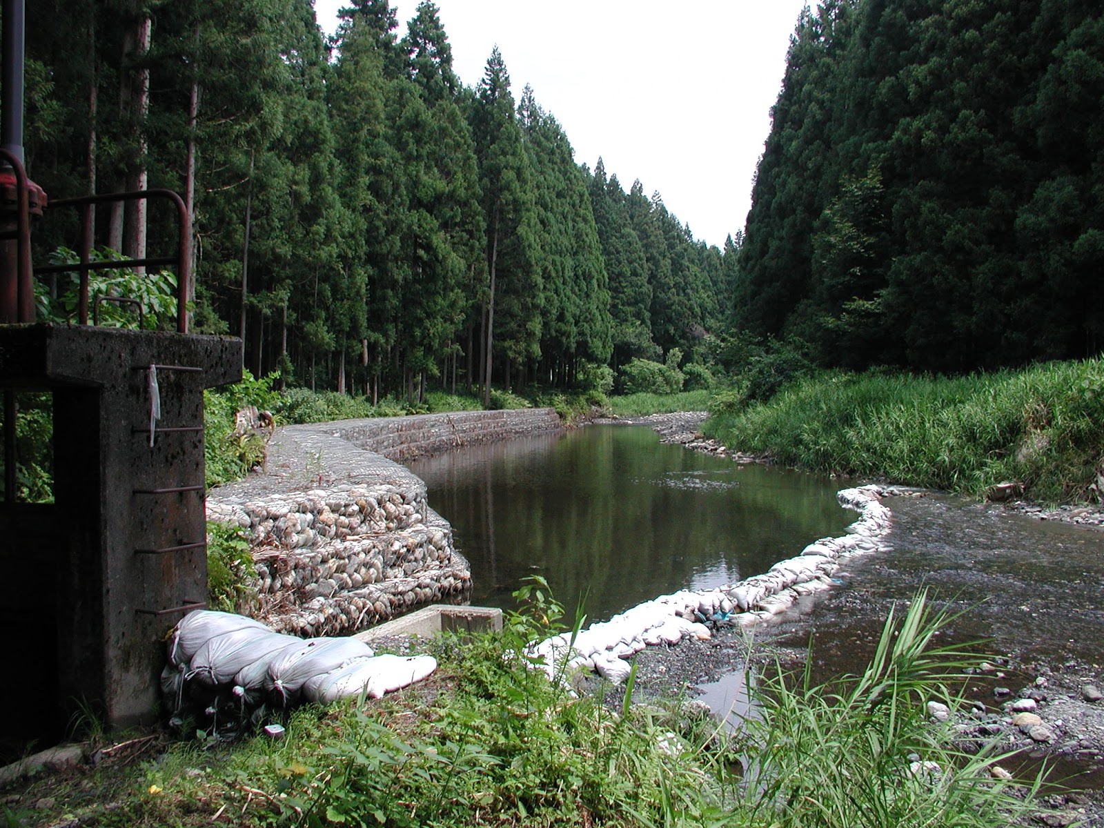
Stage = 33cm with clear water
The water level was about 11cm lower than at the end of May. Now we enter a season of relatively little water, as the snowmelt season comes to an end, and we wait for the arrival of the rainy season later this month. Looking at the hydrograph below, we can see the diurnal snowmelt pattern has gone by early June. The small peak on May 31, when there was no rainfall, perhaps marks the end of the snowmelt season for Takiya River. Of course, other basins with higher mountains (e.g. Iide Mts. >2000m) still have lots of snow and snowmelt continues in those basins until late summer. But for Takiya River (max. elevation <1000m), the snow has mostly gone and the water in the river is decreasing day by day.

Water levels are falling at the end of the snowmelt season

After measuring the discharge in Takiya River and one of its tributaries, we download the data for water stage, precipitation and shortwave solar radiation. Then it's time for lunch by the river, and Honma san is in his element as he cooks up some sansai (mountain vegetable) miso soup using fresh sparkling water from Takiya River - absolutely delicious! Thank you every time Honma san.

Sansai (fuki) miso soup