Tuesday, 1 September 2015

August 15 flash flood


August saw dry conditions return again for the first two weeks, before a sudden flash flood of moderate size on August 15, when river stage rose by about 50cm during just 10 minutes from 11:40 to 11:50, reaching a peak of 1.0m.

Analysis of the local Amedas precipitation at Takane and Miomote shows that the storm path was from north to south, or in other words, the storm path was moving in the downstream direction. This likely contributed to the extremely sudden rise in the stage hydrograph.

North of the basin (Takane) intense precipitation of 6~8mm/10 min. occurred during 9:20~10:00, while south of the basin (Miomote) intense precipitation of 6~12mm/10 min. occurred during 10:30~10:50. Maximum hourly precipitations were 36mm at Takane, and 24.5mm at Miomote.

The series of images below is taken from time-lapse photography at the gauging site. The first five images show the arrival of the intense precipitation, and the last three images show the sudden rise in the river stage.


Wednesday, 29 July 2015

Below average precipitation


Although the hydrograph above shows small to moderate peak flow events during July, the total precipitation for the month was well below average (170mm compared to 30-year average of 263mm). The full force of the rainy season never arrived in Niigata this year. Continuing dry conditions in the first half of the month allowed flows to decrease to similar levels as late June (pre-rainy season). Interestingly the ET induced diurnal fluctuations become less clear as the lowest flows are reached.

The peak flow on July 18 was due to 31mm daily precipitation at Miomote, while the multi-peak flow during July 23-24 was due to nearly 90mm total precipitation and a peak hourly rate of 19mm/h.

Wednesday, 8 July 2015

Low flows and peak flows


This year has seen below average precipitation during June (125mm compared to 180mm average). You can see in the hydrograph above that the period 17-26 June was completely dry, and we can even see small downward dips in the water level during day-time as evapotranspiration rises. This phenomena is only seen during mid-summer when river and ground water levels are relatively low and soil conditions are dry. A minimum stage of 0.261m is observed on 26 June.

During 27-28 June a rainstorm drops 66mm (max. 9mm/h) causing a moderate peak flow. However, soil and ground water storage is barely replenished, and flow levels quickly decrease to near 0.3m after a week or so.

Ta = 22C, Tw = 17C, Stage = 0.32m, Q = 0.357m3/s

Today we also carried out a survey of the channel long-profile, measuring by level the elevation of the channel thalweg and the water surface slope. Over the 90m reach shown in the photo above, the channel slope was 1.14%, while the channel slope over the 100m upstream of the gauge was 0.78%. The overall water surface slope for the 190m reach was 0.948%, with a drop in elevation of 1.801m.


Considering the reach between 50m upstream and 50m downstream of the gauging point, the slope was 0.84% compared to 0.90% surveyed in 2004. This suggests the slope at the gauging point has decreased slightly since 2004. We are currently undertaking an analysis of the hydraulic geometry and stage-rating curves for the gauging point, for which estimates of channel slope are essential. Measurements of channel slope during flood discharge will also be required.

Wednesday, 17 June 2015

Low-flow season


The snowmelt season has now finished for the Takiya basin, and we enter a period of low-flows as dry weather continues through the first 2-3 weeks of June. The hydrograph above shows an overall downward trend in water levels - the diurnal snowmelt pattern disappears at the end of May and after that several small rainfall events interrupt the decrease in flows.

Rainy season has already been in full swing in Kyushu and southern Japan, but it seems the rains will not arrive in Niigata yet. Until the rains come, we will see some of the lowest flows during a year. Annual minimum flows usually occur before the rainy season arrives in late June, or at the end of summer in late September.

Torrential localized rainfall has been a feature of the weather in Japan over the past week as unstable atmospheric conditions prevail. Today the precipitation station north of Takiya basin (Takane) recorded 54mm/h during a storm, while the Miomote station to the south recorded zero rainfall.

Stage = 31.5cm, Q = 0.32m3/s, Ta = 24C, Tw = 17C

Miomote gauge (JMA Amedas network)

Tuesday, 26 May 2015

Snowmelt season draws to a close


The above hydrograph shows how water levels have receded over the past three weeks as snow cover has receded during mostly fine and dry weather. The most recent four days still show a slight diurnal snowmelt response, but it is much smaller in size than at the start of May, indicating snow cover has almost disappeared in the basin. On 1 May discharge was around 2.8 m3/s, but it has fallen to just 0.56 m3/s by 26 May.

There are two noticeable peaks due to rain-on-snow. The first event on May 4-5 occurred after 39 mm of rainfall, while the second event on May 15-16 occurred after 47 mm of rainfall.

Stage = 38 cm, Q = 0.56 m3/s, Ta = 22C, Tw = 14C

Monday, 18 May 2015

JICA study tour


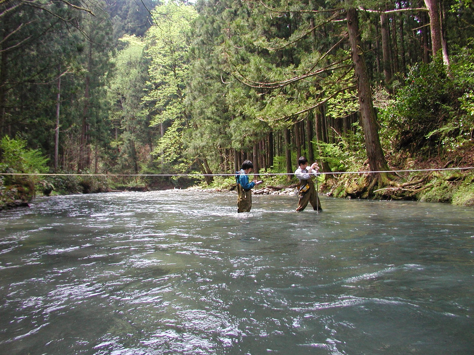
Today I introduced participants from a JICA irrigation and drainage course to the Takiya River field site. Our main exercise was to split into 4 teams and measure the discharge by different methods; (1) electromagnetic current meter with wading rod, (2) hand-held propellor meter, (3) bridge-suspended propellor meter, and (4) float method. The stage was 0.47 m, which is typical for the tail-end of the snowmelt season. Methods 1 and 4 gave a similar result of close to 1.32 m3/s, whereas the propellor meter methods gave somewhat higher estimates. Reasons for the differences are being investigated.

Hand-held propellor method

Bridge-suspended propellor meter method

Electromagnetic current meter method

Float method


Friday, 1 May 2015

Diurnal snowmelt pattern


The last 9 days of April show the typical diurnal snowmelt pattern where water levels rise and fall at a daily frequency due to fluctuations in the snowmelt energy balance between daytime and nighttime. The pattern is especially clear due to the fact that no precipitation at all fell during this time.

The moderate flood peak on April 20-21 was due to rainfall of up to 10 mm/h and an event total of nearly 60 mm (rain-on-snow event).

Stage = 58cm, Discharge = 2.84m3/s

Although levels of suspended sediment were very low, we could observe fine gravel-sized bedload moving on the streambed in the central part of the channel where depths were about 0.45m and velocities about 0.85m/s.