Tuesday, 26 March 2019
Winter runoff data download
First time to download the water level data loggers after the long winter season. Here I am plotting the data from the Kadec logger, which shows there were three notable rain-on-snow (ROS) peaks (2 Feb, 20 Feb, and 12 Mar) all with a peak stage of about 0.8m. Low winter baseflow continued for about one month from late December to the first ROS event on 2 February. After the second ROS event on 20 February the base flow remains higher as we enter the snowmelt season.
Marginal snowpack remains in the forest around the stream gauge. The snow lysimeter at the larch site was relatively more exposed than at the cedar site. It is normal for the larch site to melt-off a few days before the cedar site. Melt-off dates seem likely to be close to average (end March to early April). The lack of ponding in the larch lysimeter trays indicates good drainage conditions with no problems.
Thursday, 7 March 2019
Snowmelt season in full swing already
 |
| Mountain site (elevation 200m) |
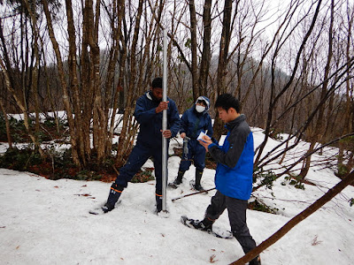
Snowmelt season has arrived very early this year, and there has been significant melt since the last snow survey on February 13th. The relative snow density is already up to around 0.42, compared to about 0.30 on February 13th. Surprisingly, melt has progressed much more rapidly at the higher elevation mountain site (200m) compared to the valley site (60m). Possible reasons are frequent temperature inversions during early spring season, and greater exposure to solar radiation and warm winds at the mountain site. Both sites have deciduous forest cover.
Snow survey summary
(depth / density / SWE)
Valley (60m) Mountain (200m)
Feb 13 111cm / 0.30 / 33.6cm 120cm / 0.28 / 33.3cm
Mar 7 60cm / 0.42 / 25.2cm 48cm / 0.42 / 20.1cm
 |
| Mountain site |
 |
| Valley site (elevation 60m) |
 |
| Snow lysimeter at valley larch site |
 |
| Tracks of "kamoshika" deer (like a mountain goat) |
 |
| Takiya River |
Subscribe to:
Comments (Atom)


